Under the Surface: Ecohydrology Students Take a Closer Look at Wetland Hydrology
Throughout the Southeast, ephemeral wetlands dot the landscape, providing important ecosystem services such as carbon storage, nutrient cycling, and flood buffering. These embedded communities also serve as biodiversity hotspots, often home to rare, threatened, and endangered species. Because of these critical roles, land managers must consider the conservation of these ecosystems in tandem with the surrounding landscape. Climate change, land use, and a history of management neglect can alter these ecosystems’ hydroperiod, which is the amount of time a wetland holds water throughout the year. Understanding a wetland’s hydroperiod and other hydrologic traits can inform conservation strategies that aim to preserve these important ecosystems.
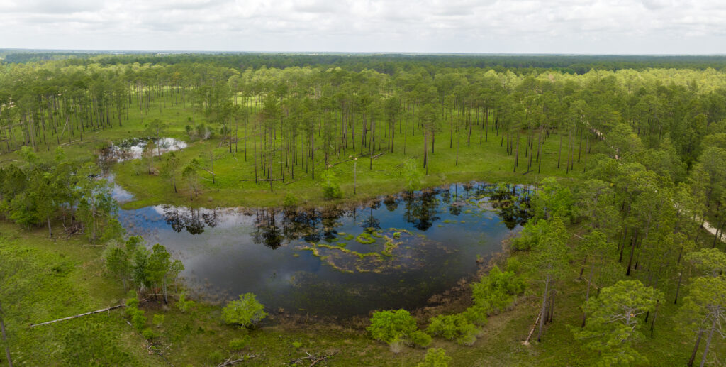
A geographically isolated wetland within a longleaf pine forest.
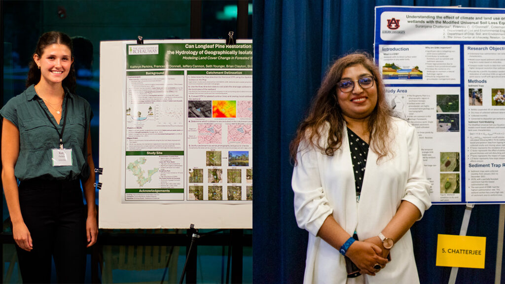
In The Jones Center’s Ecohydrology Lab, graduate students Katy Perkins and Suranjana Chatterjee are working to further our understanding of wetland hydrology and how different tools can aid research and conservation goals.
Katy Perkins (left) and Suranjana Chatterjee (right) present posters on their work.
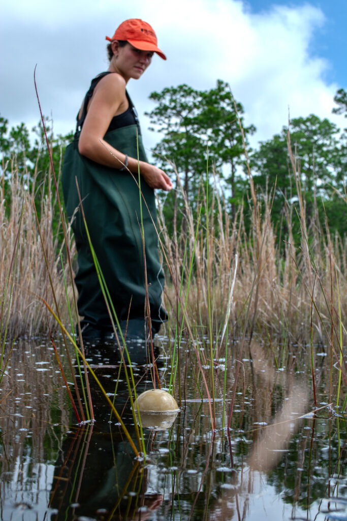
Both at Auburn University, Perkins and Chatterjee are tackling wetland hydrology from different angles. Perkins is studying how land cover and catchment area impact the hydrology of a wetland to elucidate the impact of land management practices on these systems. She found that thinning the surrounding forest of a wetland can increase its hydroperiod due to decreased vegetative water use following removal. Perkins investigated further by using a modified fish finder (sonar instrument) to take depth readings across the wetland, creating 3-D maps of the wetland basin.
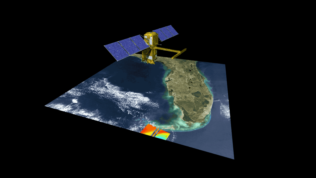
While Perkins works to understand wetland hydrology and management on the ground, Chatterjee is the eyes in the sky. She is utilizing NASA’s Surface Water and Ocean Topography (SWOT) satellite to monitor wetlands from above. With over 100 isolated wetlands at The Jones Center at Ichauway and thousands more in southwest Georgia alone, monitoring water levels and hydroperiod of each wetland on the ground would be nearly impossible. By testing the effectiveness of the SWOT satellite data, Chatterjee is aiming to develop more efficient tools to monitor the hydrologic state of our wetlands on a landscape scale. Combined with Perkins’ work, the two graduate students are taking vital steps to ensure proper management of our wetlands to preserve the future of these critical ecosystems.
Animation of the SWOT satellite collecting data.
Katy Perkins using a modified fish finder to collect bathymetric data in a wetland via SONAR.