Natural Resources Research & Management
Natural Resources Research & Management
Light detection and ranging (lidar) is a technology for
measuring elements of forest structure such as basal area,
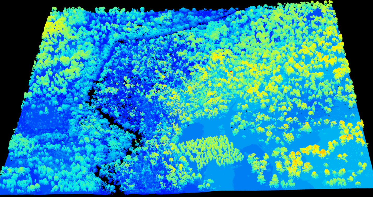
wood volume, and biomass. Scanning a forest with lidar
creates a 3-D cloud of points that represent forest vegetation
(Figure 1). Because lidar can be collected from airplanes,
it can cover large areas and reach remote places, allowing
data collection from forests where field-based surveys are
challenging.
Methods for lidar data processing are often fine-tuned for a
specific forest type. But these methods may not transfer when
applied to new forest types. Older methods use area-based
measurements which summarize information from lidar point
clouds (such as average point height). This is then calibrated to
sampling plots on the ground where wood volume is known.
However, newer approaches combine area-based information
with information from 3-D pixels known as voxels to provide
richer information that is more transferable to diverse forest
types.
The structure of a longleaf pine forest is variable and can
change along topographic features such as ridges and slopes.
We tested whether including voxel-based methods improves
predictions from lidar data in longleaf pine forests. We
predicted wood volume in nine longleaf pine forest types
using only area-based information. Then, we predicted it again
using both area- and voxel-based information. Adding voxel
information improved estimates of wood volume. It also made
estimates more transferable across diverse forest types. This
is because voxel-based methods better distinguish
the open conditions beneath the canopies of
longleaf pine forests from the dense conditions
beneath hardwood-dominated forests.
Lidar data are becoming widely available across
the U.S. Georgia and Florida have both recently
collected statewide lidar. Widespread availability
of lidar data can allow researchers to monitor
longleaf pine forests over much of their range.
Because voxel-based methods require little fieldbased
data for ground truthing, this method is
useful for monitoring ecologically and economically
important forest types.
Whelan, A. W., Cannon, J. B., Bigelow, S. W., Rutledge, B. T., & Sánchez Meador, A. J. (2023). Improving generalized models of forest structure in complex forest types using area- and voxelbased approaches from lidar. Remote Sensing of Environment, 284, 113362. doi.org/10.1016/J.RSE.2022.113362
Andy Whelan, andy.whelan@jonesctr.org
Jeffery Cannon, jeffery.cannon@jonesctr.org